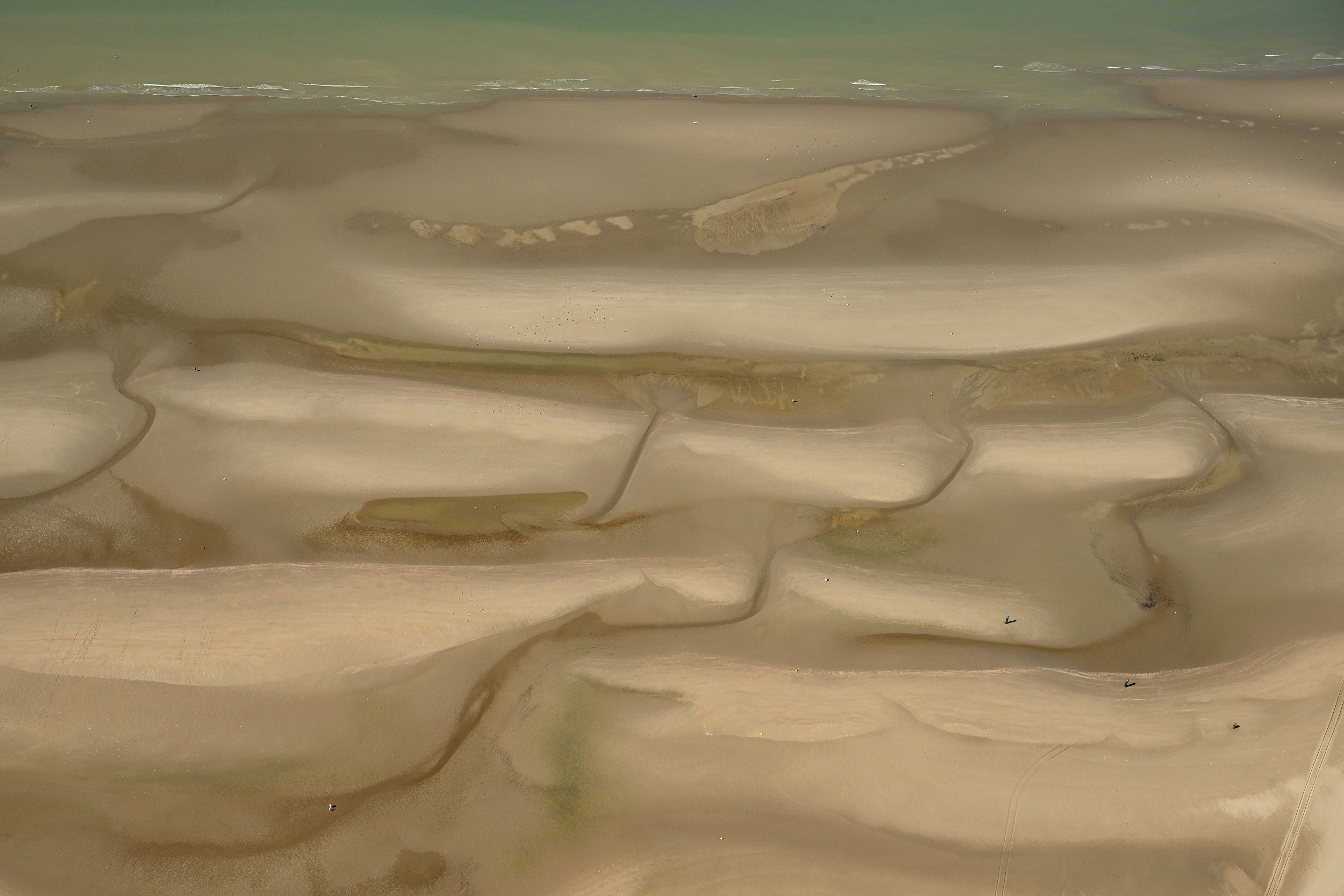
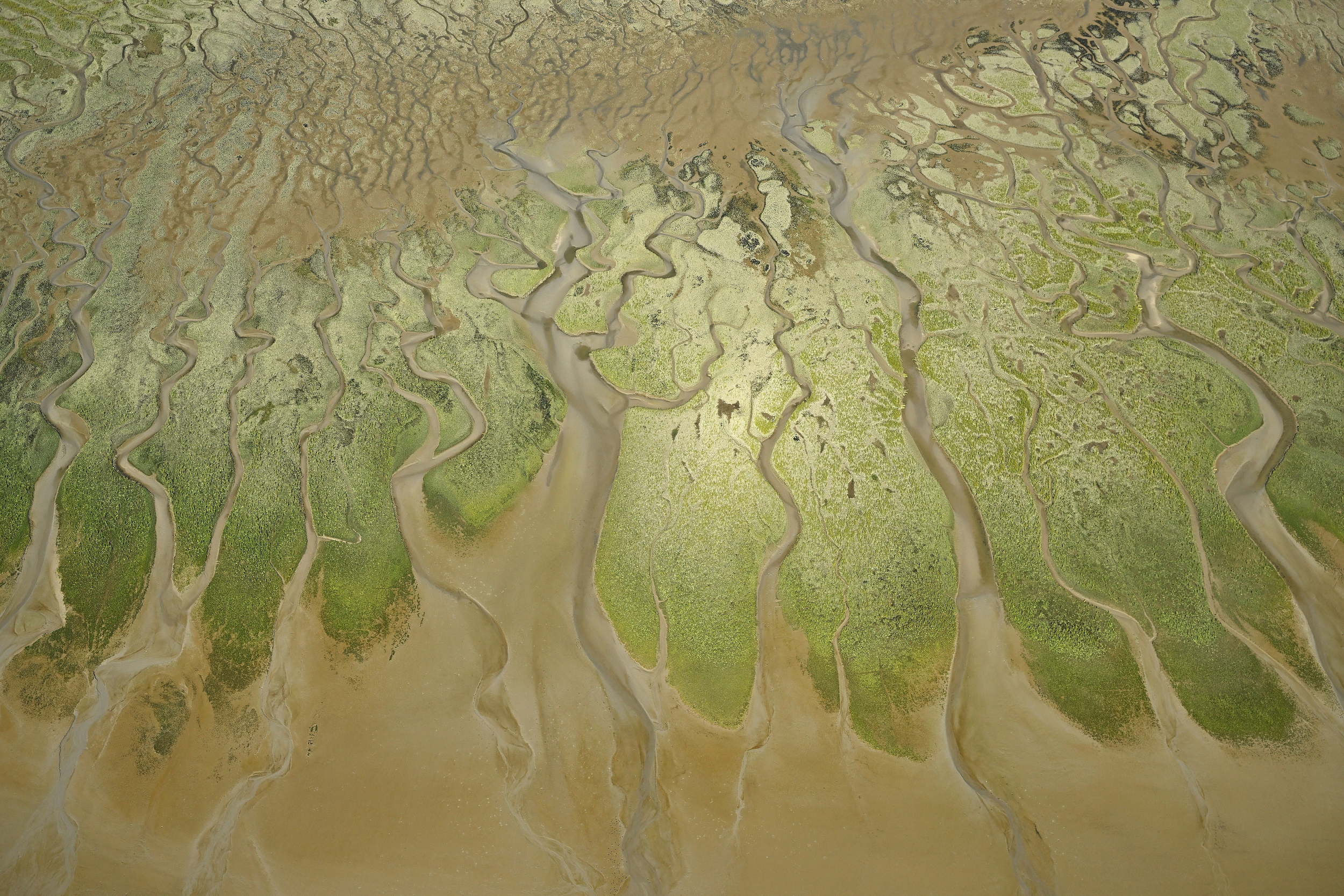
I recently completed one of my long-time bucket-list shoots: a photo flight over the Scheldt estuary during a low spring tide. The patterns formed by the sandbanks, gullies, dunes, creeks, and wetlands, combined with the water’s reflection, are truly exceptional. I’m thrilled to share these results with you!
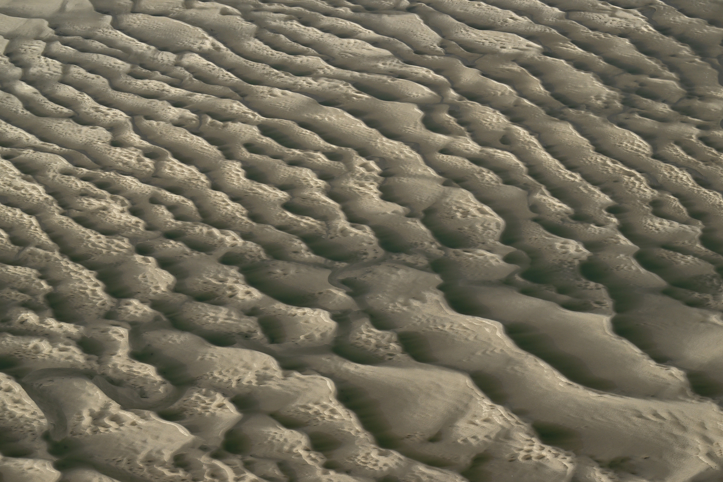
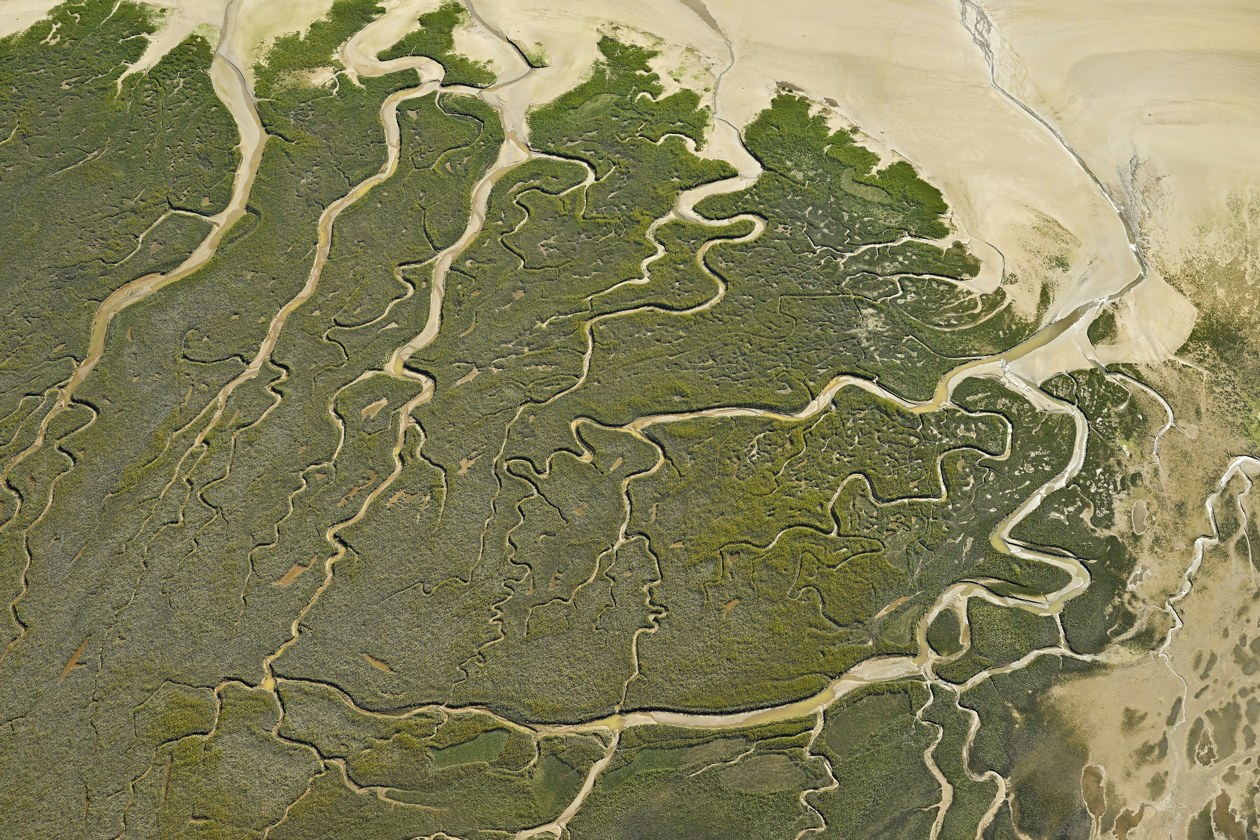
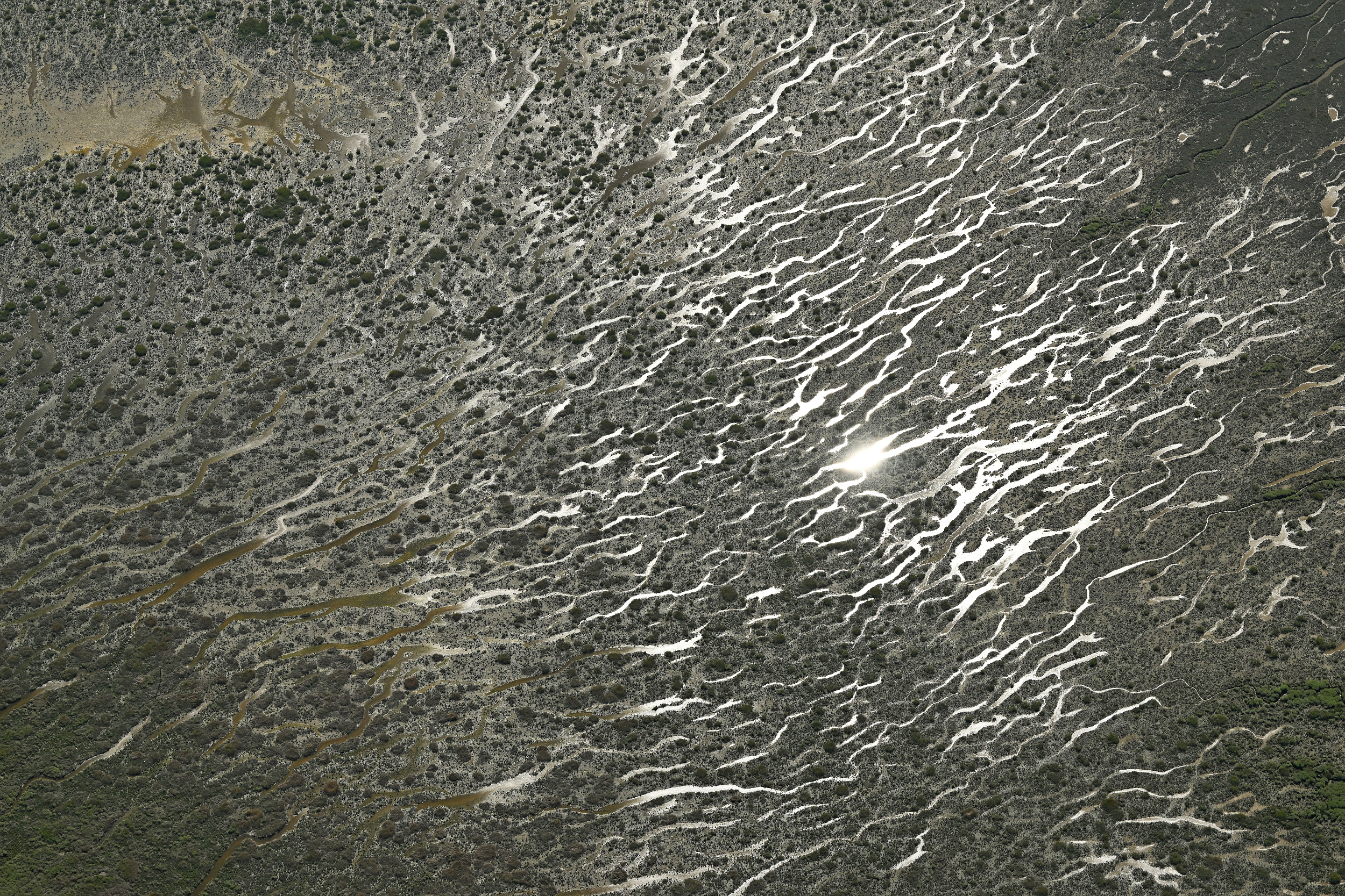
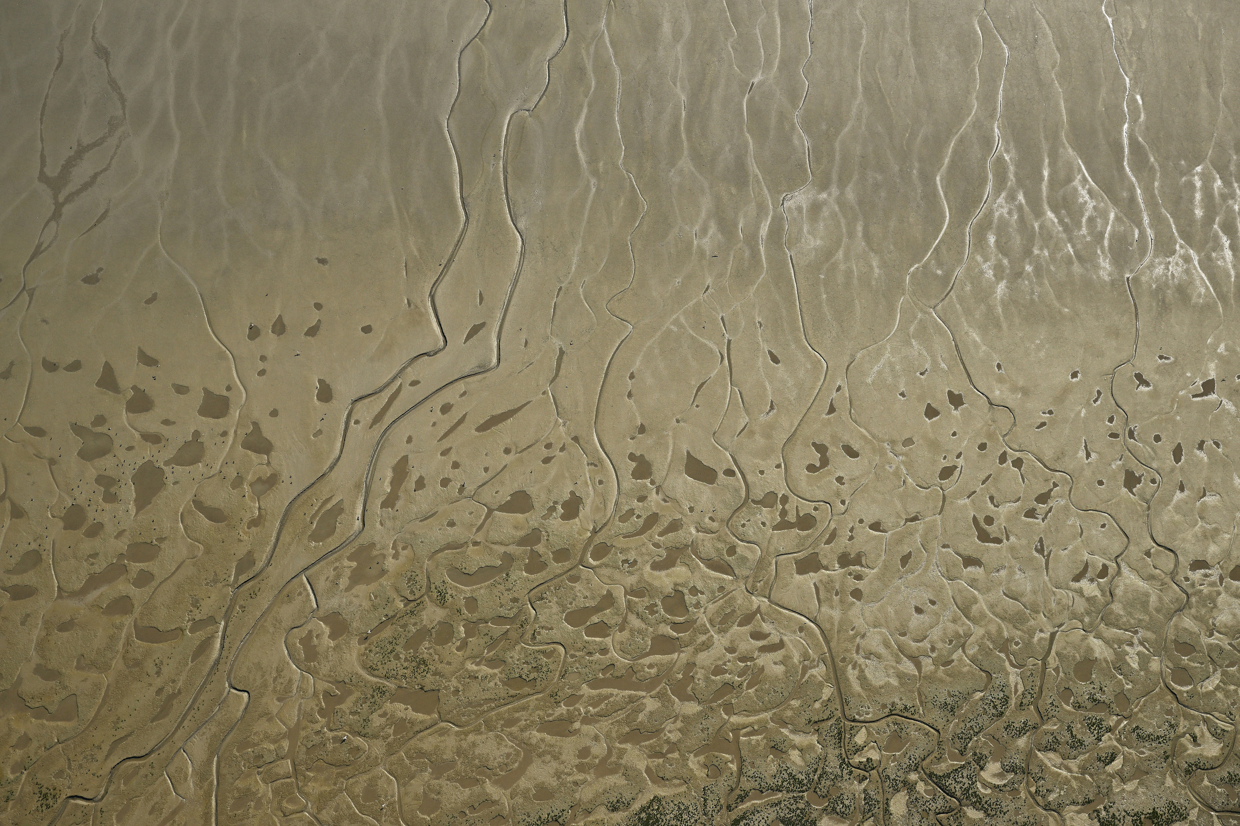
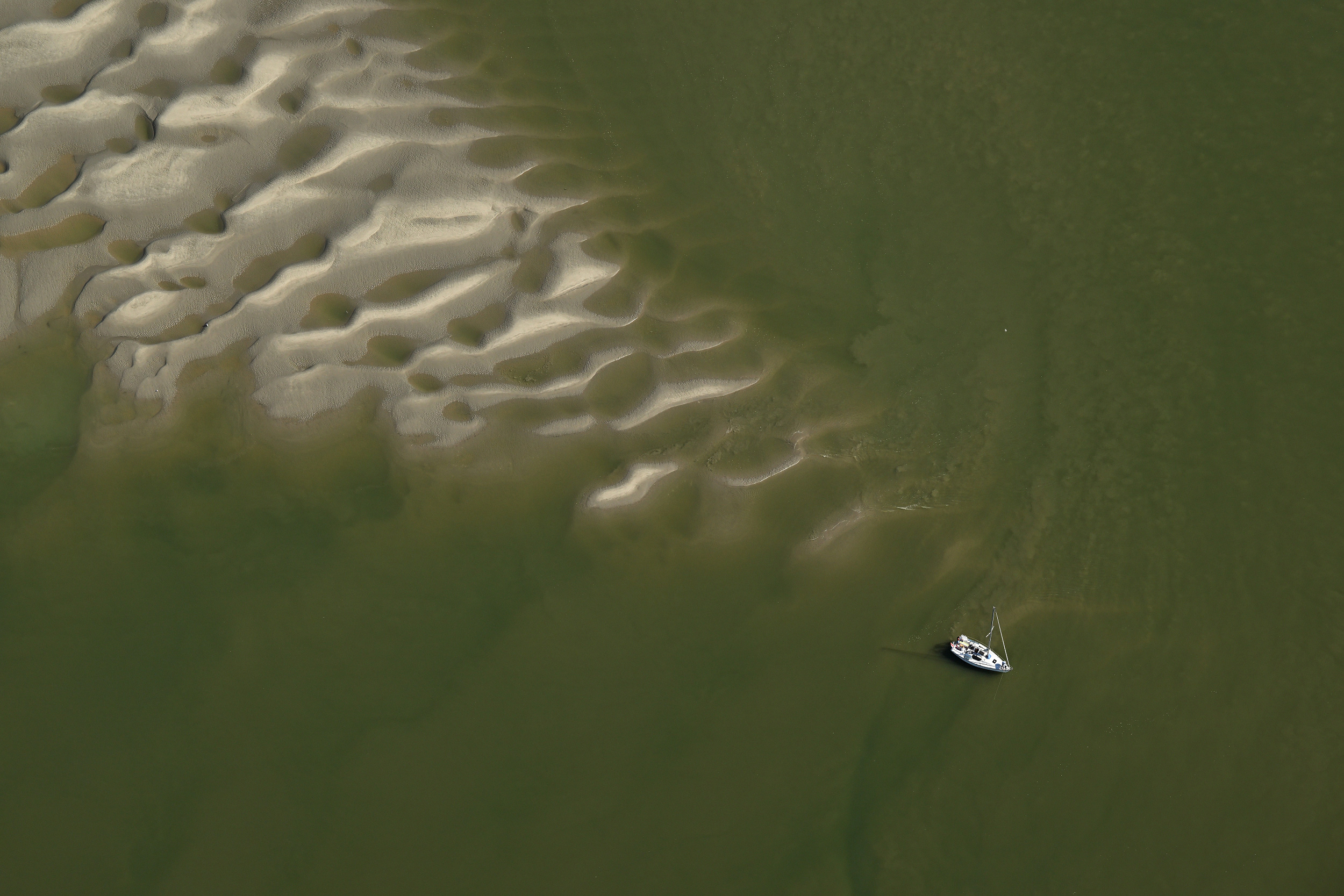
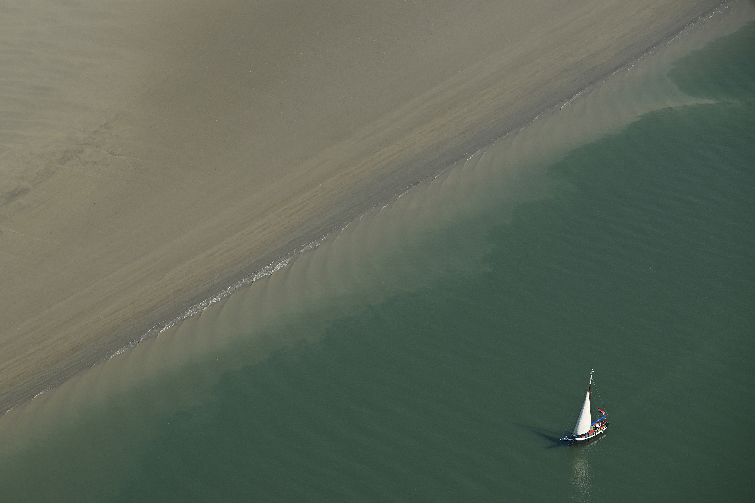
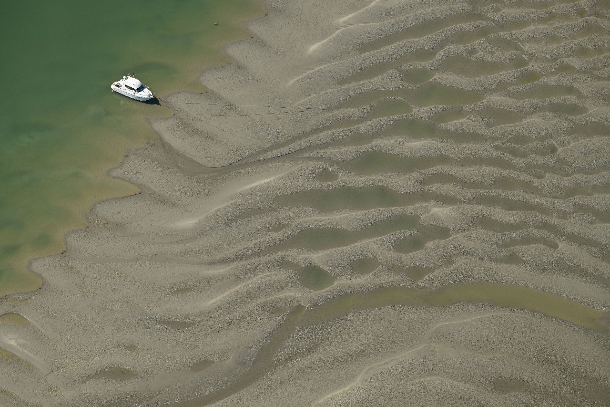
I love aerial photography, especially of flat areas that don’t reveal their shapes and patterns on the ground, such as mudflats and marshes. The view from the sky shows stunning natural designs, and when you zoom into more detail, like a boat, you grasp the incredible extent of this area.
Unique topography
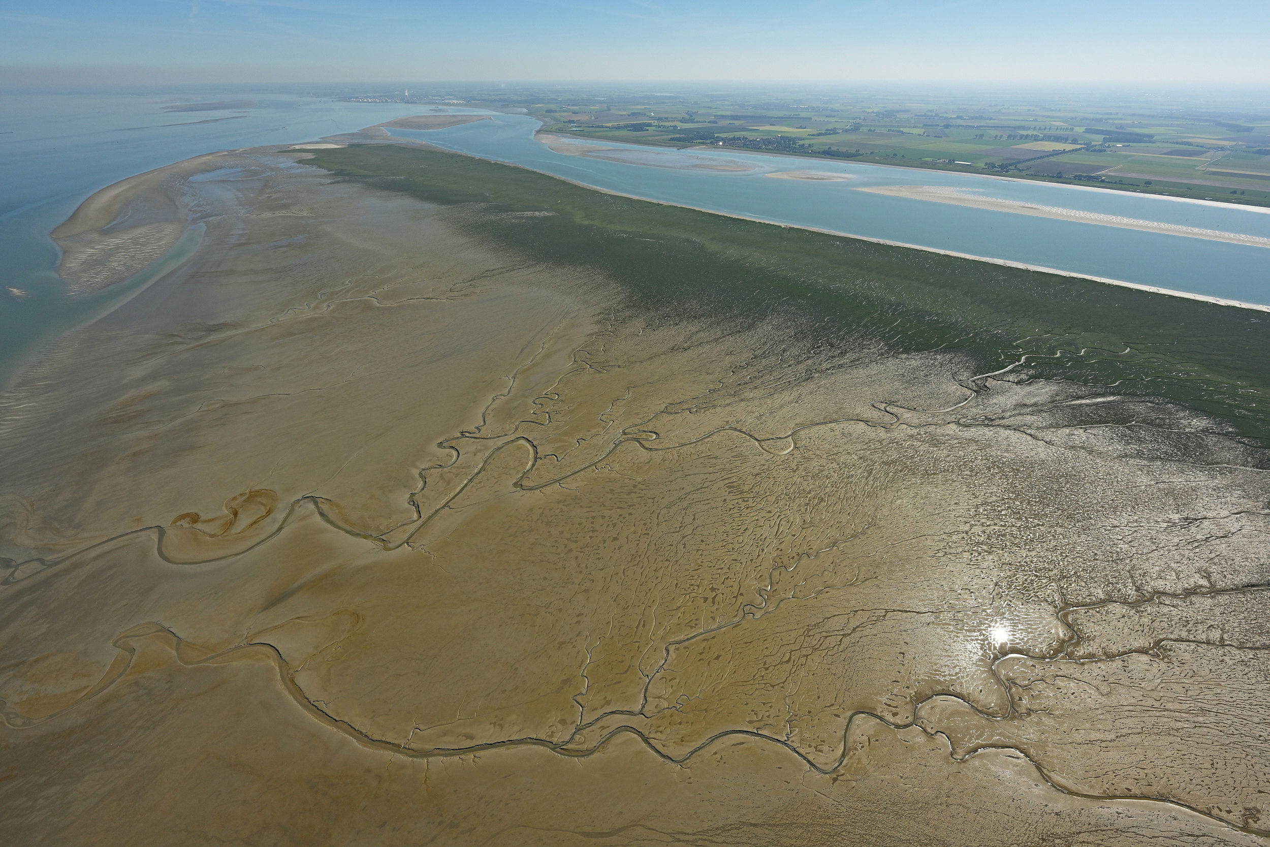
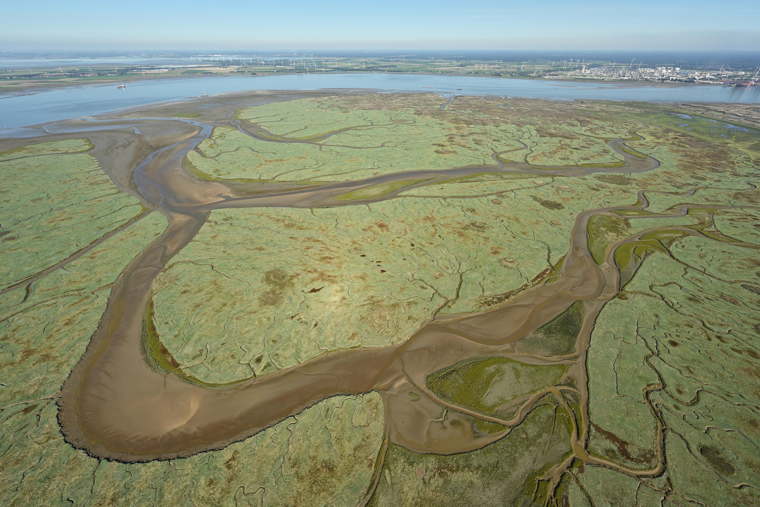
This is the mouth of the river Scheldt in the province of Zeeland, bordering Zeeuws-Vlaanderen. It’s a protected wildlife area (Natura 2000) and an important shipping route to the Port of Antwerp, one of the world’s largest ports.
The gullies are challenging to navigate by boat because of the tidal current and many sandbanks that form a narrow passage for the ships. Many heavy vessels get stuck; Zeeland’s so-called ‘Bocht van Bath’ is quite famous because of this. Have you ever heard of River Pilots? They are navigators with expert knowledge of the area who take over the helm when a heavy containership enters the area. They know the wetlands well enough to navigate the sandbanks, which is especially tricky during low tide.
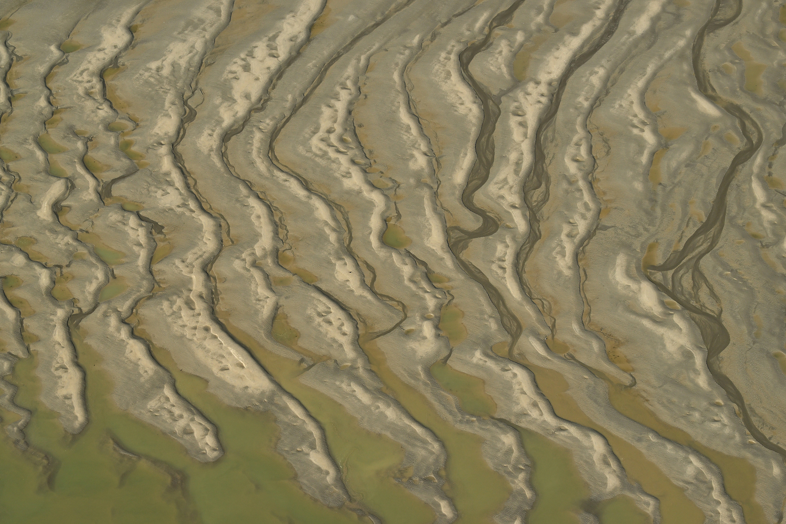
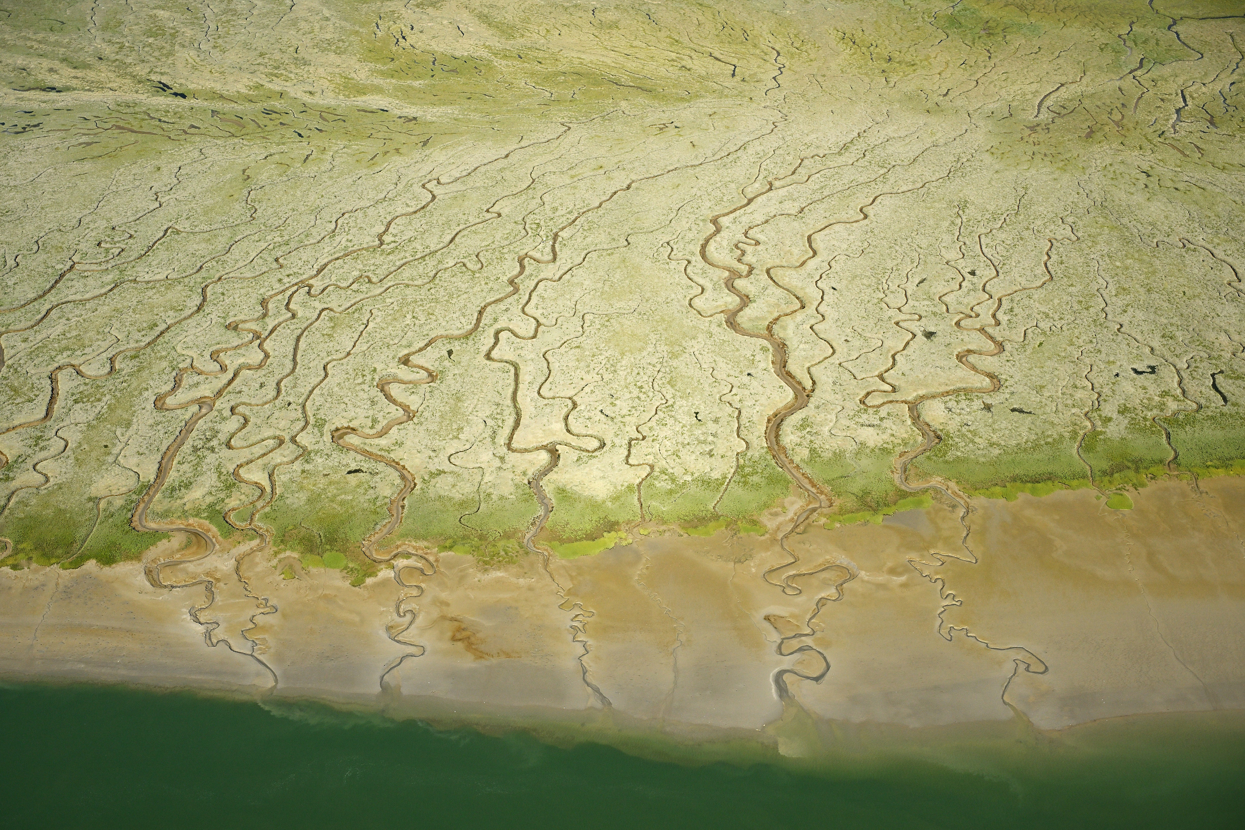
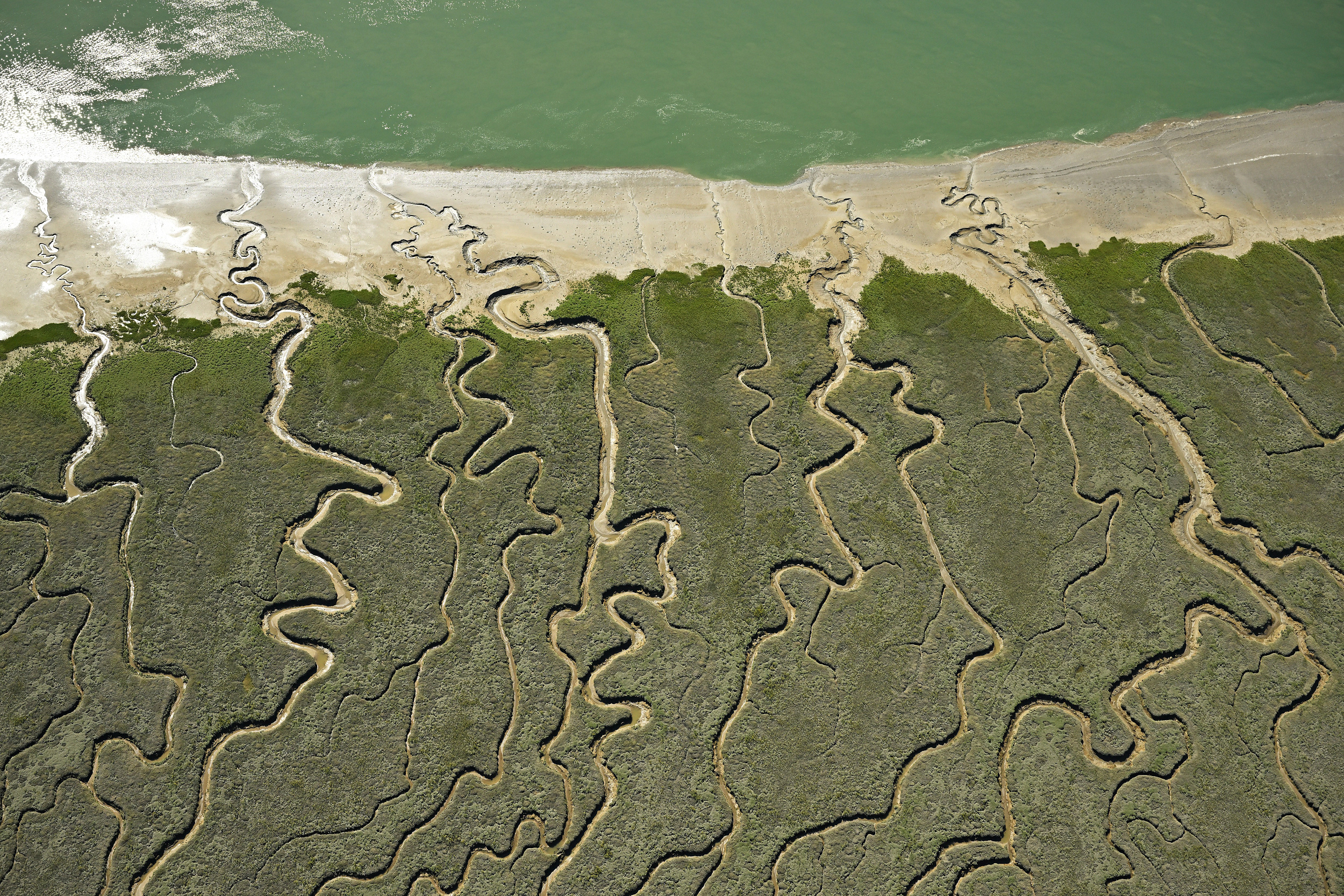
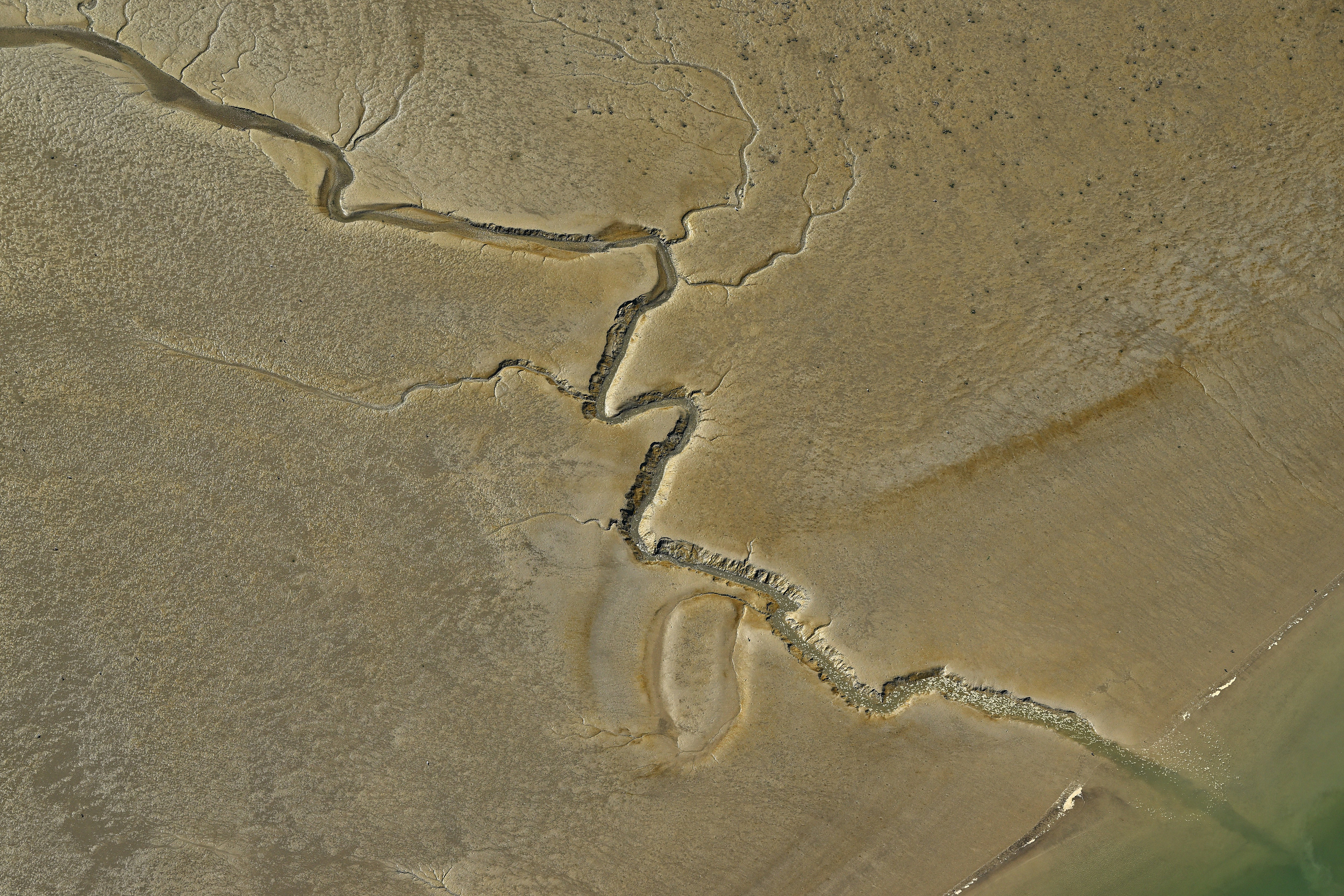
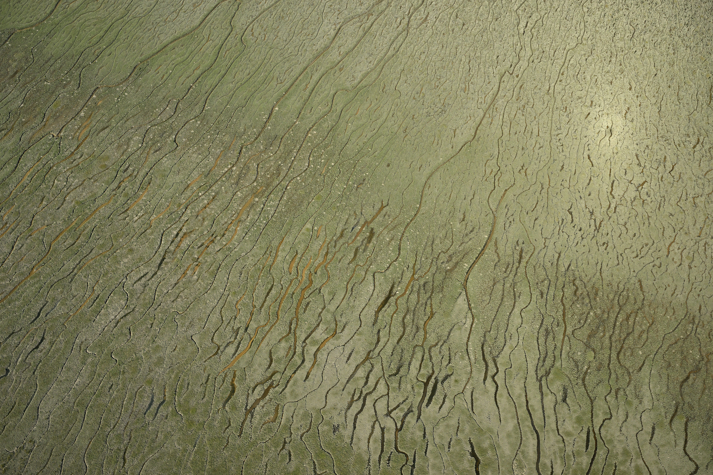
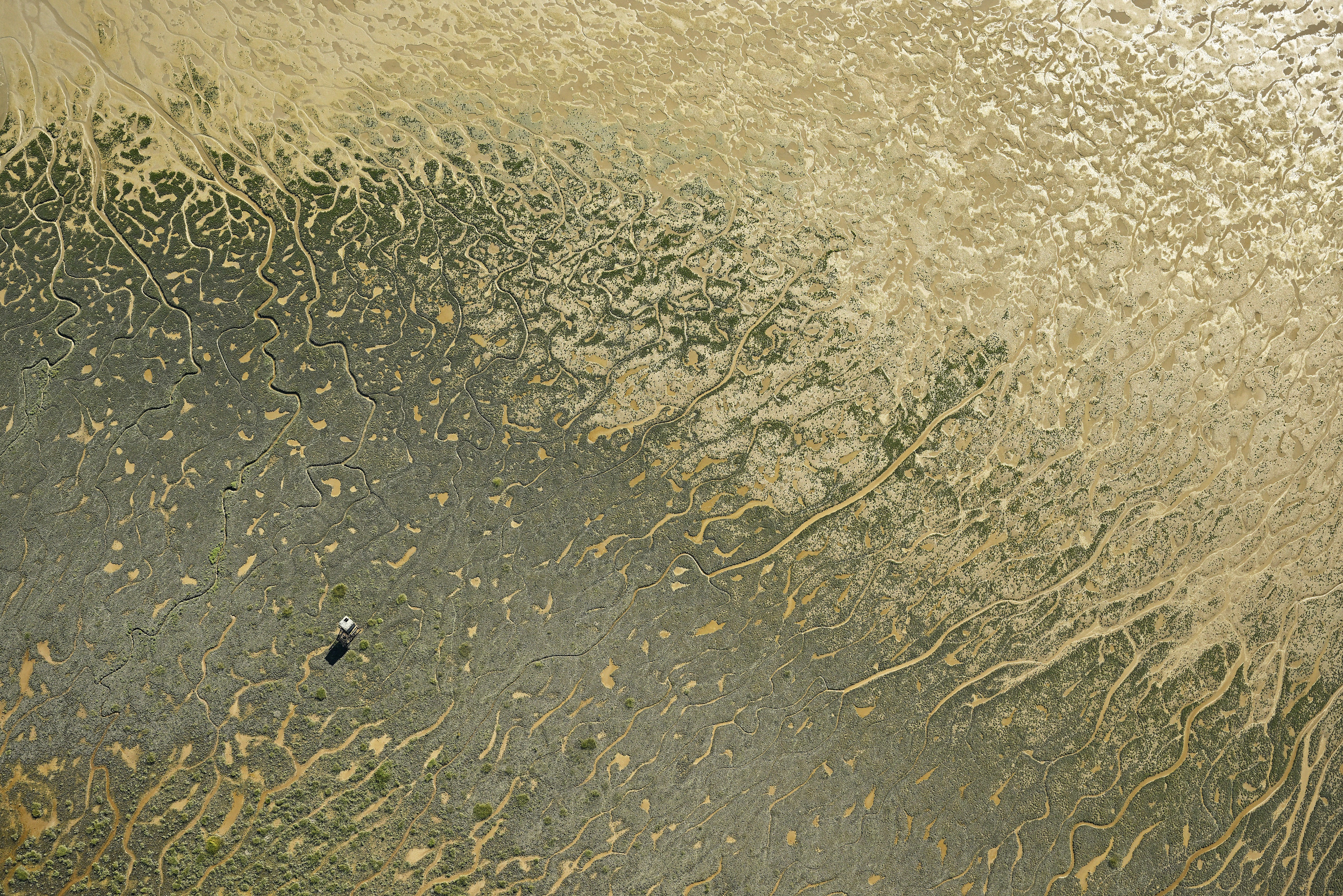
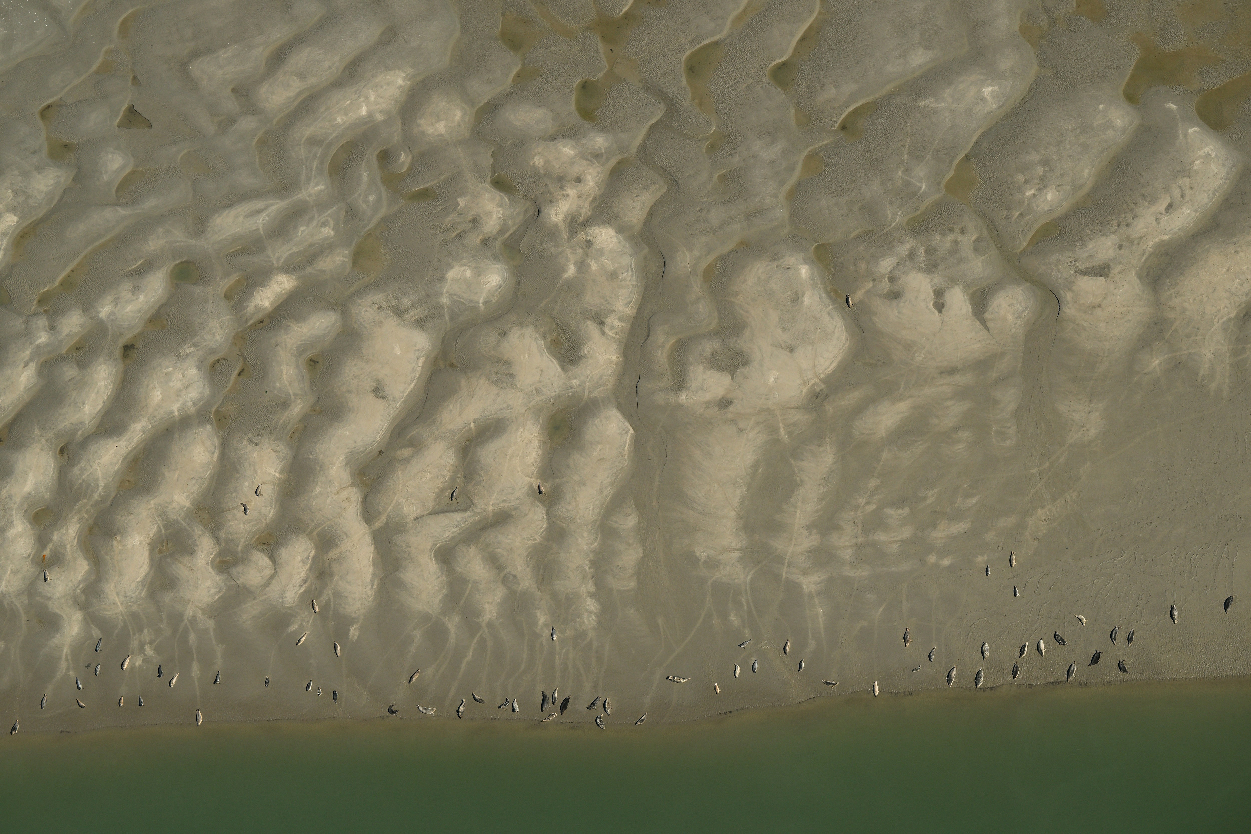
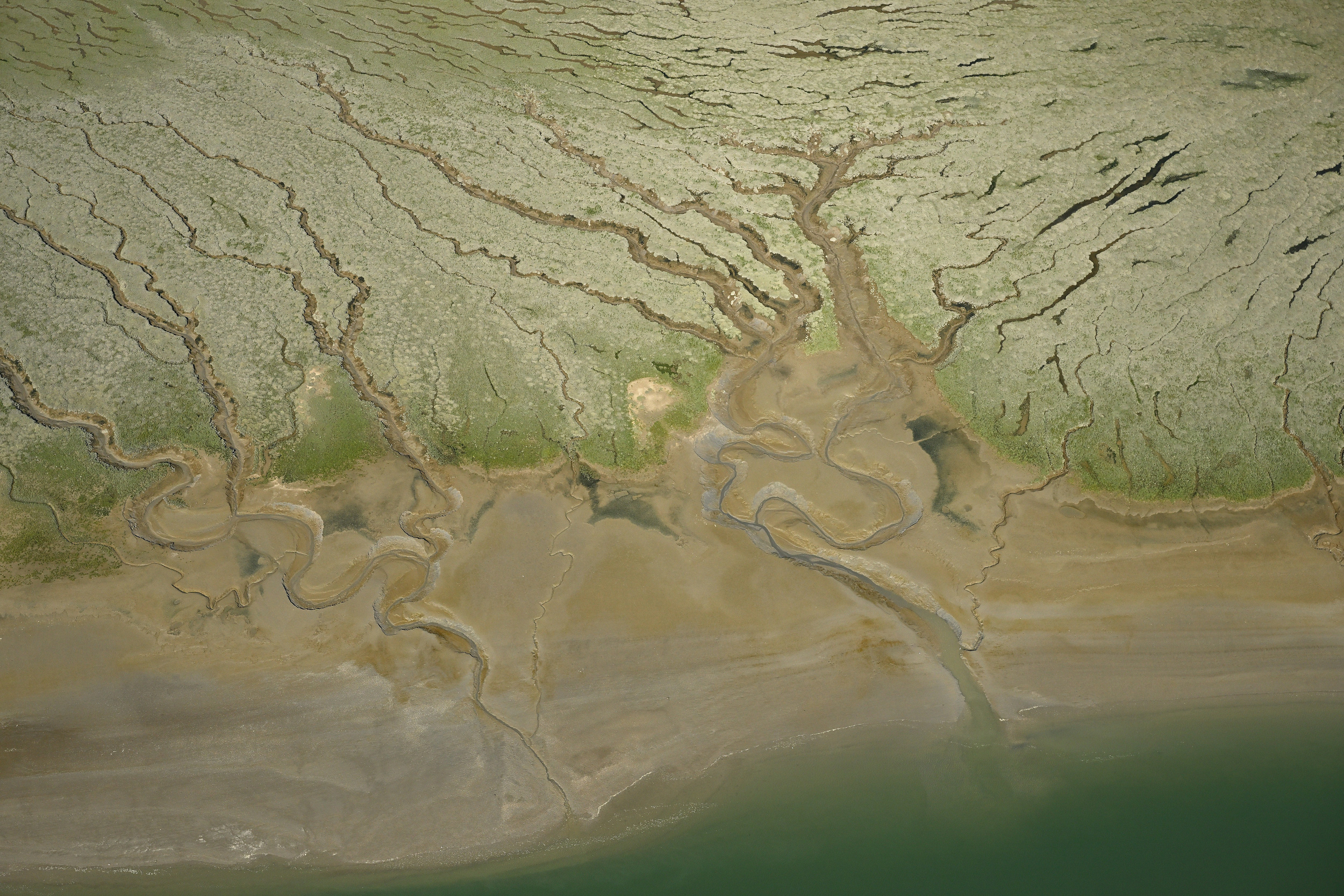
The images that look like coastlines are sandbanks that have become so high that they have formed islands that hardly flood anymore. They developed salt marsh vegetation and many gullies. Examples of this are the Hooge Platen and Het Verdronken Land van Saeftinghe.
Nature shaped by the river tides
Water is a big part of history in the west of Flanders. It has created exceptional landscapes that teach us what a big part of Flanders must have looked like before we created polders. This fascinates me.
Nature around the River Scheldt is tidal, stretching from Knokke to Ghent. This creates beautiful natural dynamics and a unique biotope. Het Land van Saeftinghe is the largest brackish water area in Europe. We should be proud of such a unique region, which only a few people ever see from the air. I’ve always wanted to share the true beauty of this place.
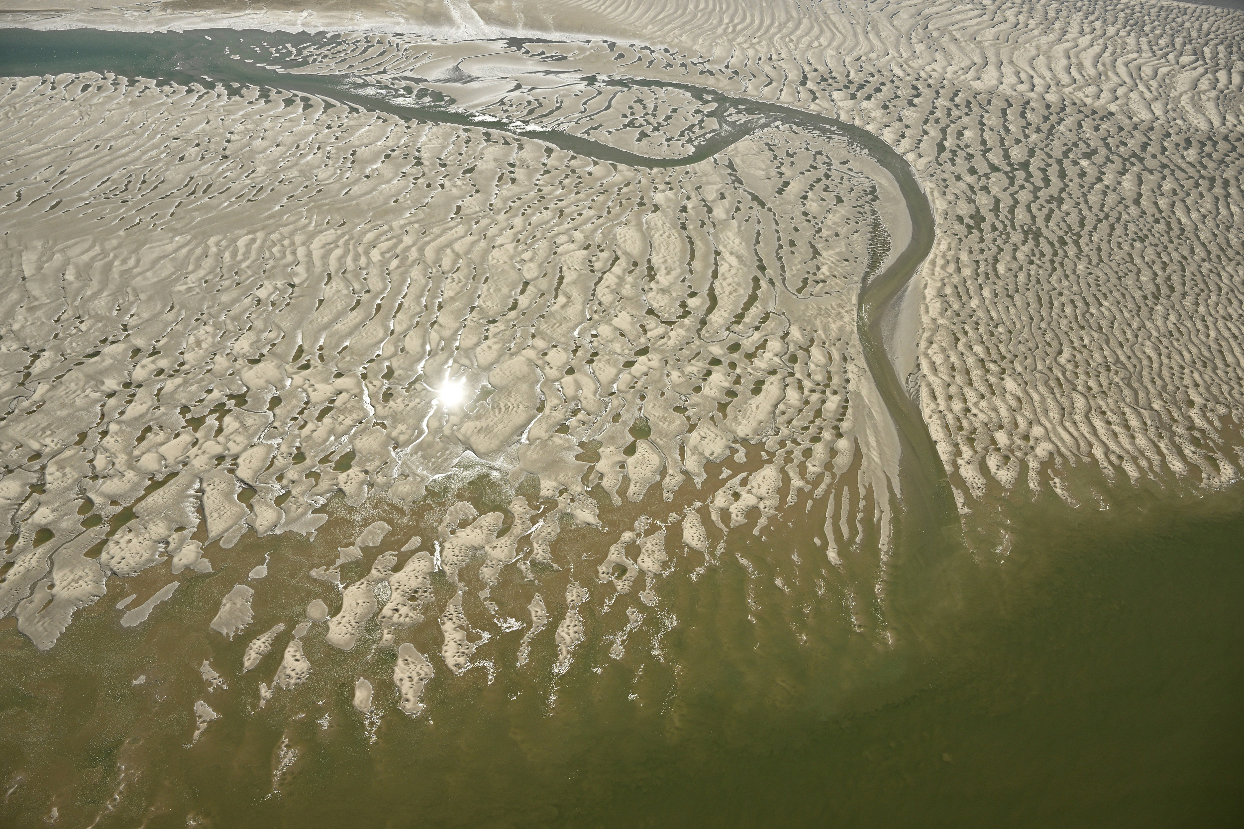
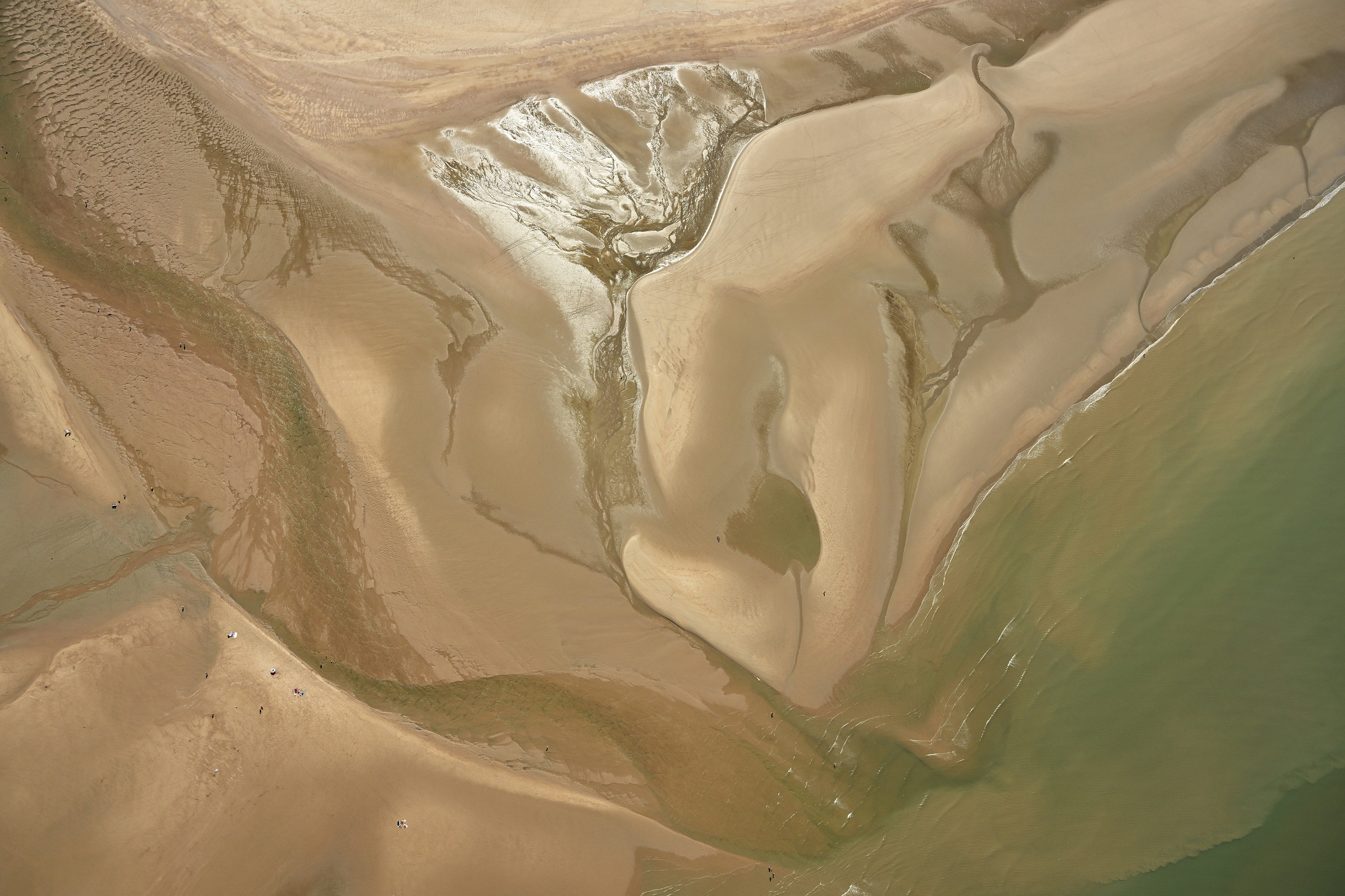
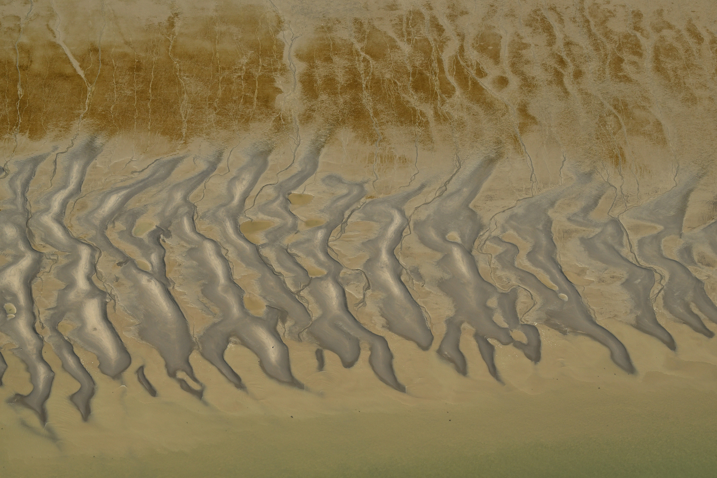
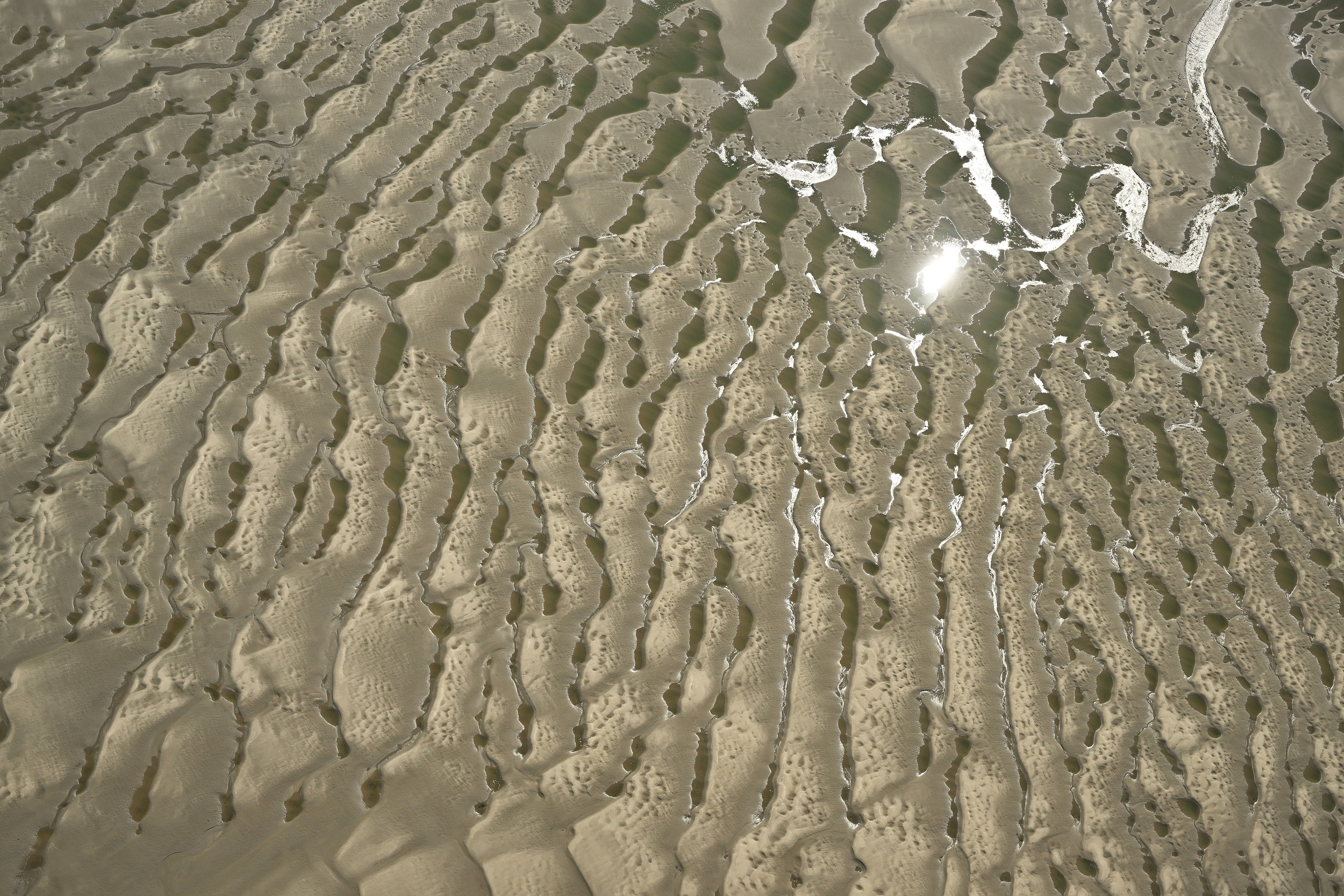
The repetitive structures and graphic scenery have always been of great interest to me. For centuries, nature has sculpted its way through a changing, dynamic environment. The abstract patterns don’t reveal their actual size; many of these pictures show an area about 100 meters wide. If you look carefully, you might spot a bird, a ship or resting seals.
A photo flight lets you see everything with your own eyes, making it much more intriguing than a remote drone shoot. I waited a long time to have the perfect circumstances: the ideal position of the sun in the year, combined with spring tide. And when that day finally arrived, we were in the air for over 3 hours, shooting roughly 5000 images. I hope you like my selection!
Please remember these pictures are copyright-protected. If you want to use them, you can find the complete series of this flight on Vilda, my image databank.